Biking The Open Roads of Colorado and the West.
Biking The Open Roads of Colorado and the West.

Biking the Open Road in Colorado, With a Few Bumps Along the Way

Colorado high grinding it out on a bike trail of bike trails.

The newly opened Grand Junction-Moab trail, a 155-mile route linked by a network of backcountry huts, and accessible only two months a year, offers an almost irresistible challenge for bikers.
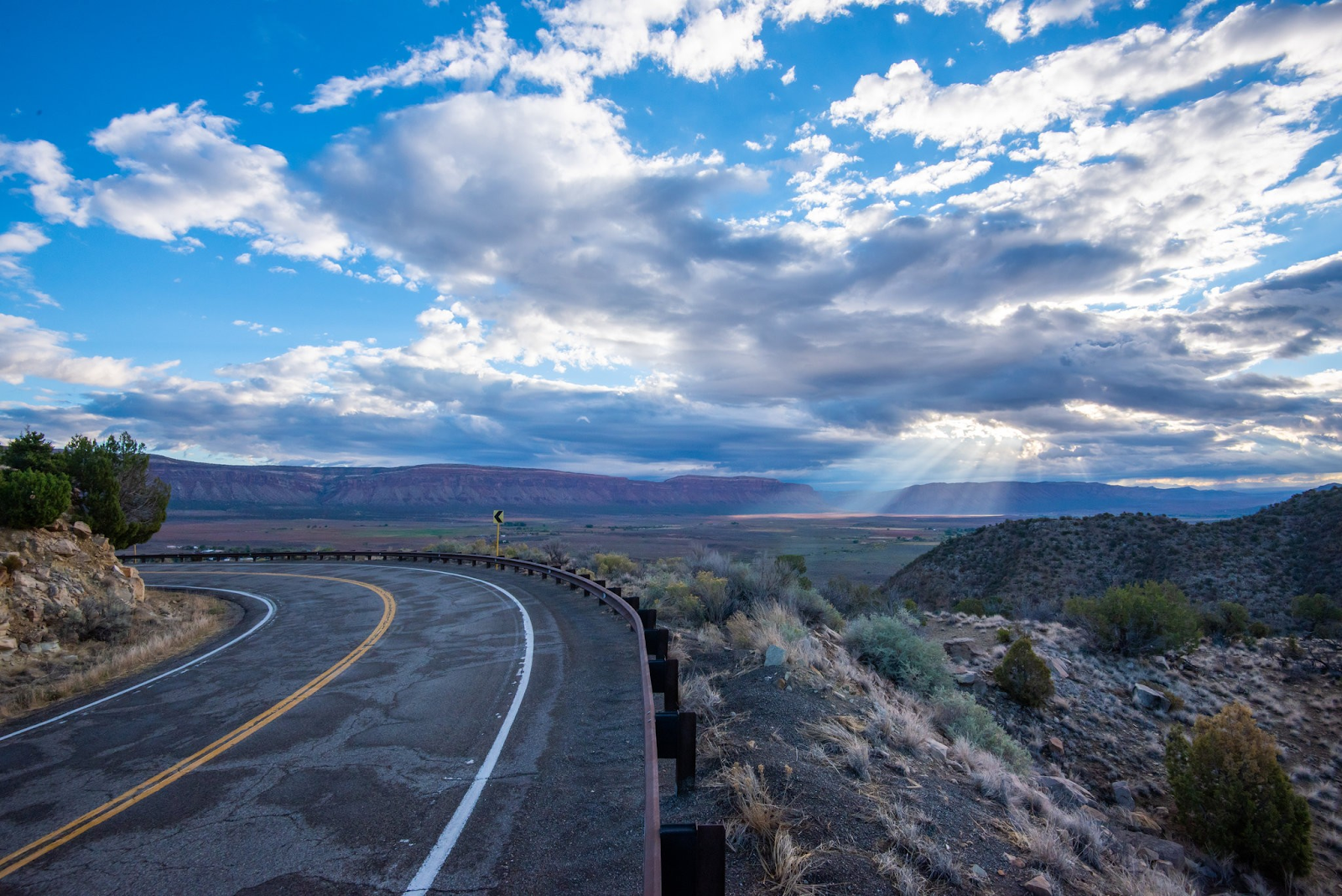
The granite cliffs of Unaweep Canyon, in the western area of Colorado, just south of Grand Junction and about 265 miles from Denver, ( 308 miles from Colorado Springs, where I was working ) are said to be some of the oldest exposed rocks in the state — roughly 1.5 billion years old, or a third of the earth’s recorded history.
Like the Garden of the Gods, this sparse, unaltered landscape has long been a source of fascination for geologists, mainly because of its shape and color. Rather than charting a one-way course (as with most canyons), Unaweep, which bisects a portion of the sprawling Uncompahgre Plateau, instead flows out in two directions, with an elevated hump in the middle, like a hose with two openings. We went by way the crows fly.
Colorado Junction Area Map image

This makes it ideal for road bikers, who see the bare, winding roads of Unaweep, and nearby Grand Junction, as an irresistible challenge. Since the 1970s, bike enthusiasts have latched onto Mesa County for its rich supply of trails. Just outside town, the Colorado National Monument makes for one of the most spectacular, high-altitude rides in America. ( The 1985 Kevin Costner film, “American Flyers,” was filmed here. )
With the recent opening of the Grand Junction-Moab route, a 155-mile ride linked by a network of backcountry huts, regular travelers can finally get a taste of what backcountry bikers have known about for years and then some.
It is the latest project by the founders of the San Juan Hut System, which launched in 1987 with a set of five huts on the north face of the Sneffels Range in Colorado. Originally meant as an easy-to-navigate route for intrepid skiers, the DIY appeal of the huts soon expanded to bikers, who take over those same trails in the summer months. Today, the system commands a total of 16 huts, spread over hundreds of square miles inside Uncompahgre National Forest.

One of the few signs of life can be found at the Bedrock General Store, looking like a time capsule out of the 1910's and which made an appearance in "Thelma and Louise."
In May, just after this new trail officially opened, I was one of the first bikers to attempt this challenging route, and adventure, accompanied by my friend, Joe, who bailed halfway through the first day. ( More on that later. )
The remoteness of the trail is a double-edged sword: on the one hand, there are razor-sharp mesas and ghostly valleys, making for unforgettable scenery. But this being rural Colorado, the weather can be unpredictable, to say the least. They say if you don't like the weather wait 5 mins. it'll change. Heat makes the trail brutally uncomfortable in summer; the wind, snow and ice make it impassable in winter. As a result, it’s only open for two months a year — May and October.
“These canyons are rough, desolate, hazardous and harsh,” explained Zebulon Miracle, a geologist who leads dinosaur walks for guests at the Gateway Canyons Resort, an unexpected luxury outpost in the middle of the red rock peaks, 53 miles from Grand Junction.
For bikers, all roads lead to Moab
But if humans have survived in these parts for a couple thousand years, then I should be able to manage for a couple days, right? And it’s not like I’d be camping out in the wilderness. Two huts, installed along the trail roughly 50 miles apart, would provide overnight shelter for the three-day, two-night journey. They are basic cabins, b- huts built of plywood, some on a concrete slab and furnished with bunk beds and a propane tank stove.
Best of all, they are fully stocked with food: bacon, eggs, tortillas, onions, canned food (beans, salsa, tuna fish), cheese, salami sticks, cookies, different kinds of dried fruit, coffee, tea and plenty of water etc. There’s even a cookbook to show how to make elaborate meals like curry or chicken parm. ( We booked our huts three months in advance of our trip, on the San Juan Huts website: sanjuanhuts.com/gravel-grinder-tour-of-the-canyons. )

Heading up the first climb of Unaweep Canyon on Highway 141.
The cost for two nights was $199. ( The “beer option” costs an additional $30 per person. )
Ahead of this trip, I had spoken with Kelly Ryan, a former ski patrol and the daughter of Joe Ryan, who founded the San Juan Huts System in 1987. According to Ms. Ryan, the Grand Junction-Moab route, though challenging, is “beginner friendly.” While this tour involves long days, the terrain itself is nothing a newbie — even someone who’s never been on an overnight cycling trip — can’t handle, she said. Plus, the relative absence of cars on this route makes things more manageable. Typically, busy highways represent a hazard for road biking. “You’re more likely to get hurt mountain biking, but you’re more likely to die road biking,” Ms. Ryan said.
This didn’t exactly inspire confidence, but then again, this wasn’t a road biking trip, per se. The route is split between old paved highways and sections of dirt, and because of that, the route is technically classified as a gravel grinder tour.
Gravel grinding, once popular in the 70s and 80s, is essentially off-road road biking, and it’s enjoying a resurgence lately. Shops like SloHi in Denver Rapha in Boulder are now renting gravel grinders and hosting group rides.
While mountain biking is often seen as too dangerous, and road biking has a reputation for being a little dull, gravel grinders offer a middle way. Their tires are thick, but more pressurized than mountain bikes, and they are more stable in their frames. Ms. Ryan called them the “Swiss Army knife of the bike world” — not as clunky as a mountain bike, but not skittish and thin like road bikes.

Two huts, installed along the trail roughly 50 miles apart, provide overnight shelter for the three-day, two-night journey. They are basic cabins, built of plywood, and furnished with bunk beds and a propane tank stove.
On a route like this, which involves long distances and rolling landscape on some unpaved roads, a gravel grinder can really shine. I opted to rent a Moots Routt 45 from a nearby Grand Junction vendor.
We were set to go.
First, one raindrop. Then, another. Uh oh. Not to worry it'll last 5 mins...
On our first morning, we left our notel motel in Grand Junction a little after 8, stopping briefly at a Wal-Mart to buy the helmets neither of us had remembered to bring. Dressed in biking shorts and long-sleeve tops, we climbed on our bikes and prepared to hit the trail, planning on covering roughly at least 55 miles per day, over the next seven hours.
Well, that was the plan. On our initial foray into the backcountry, which was a steep haul, Joe started to feel the effects of the high altitude almost immediately: the effects of the blazing sun, dehydration and arduous uphill climb had spooked him. So, we decided on a new plan: he would go back to the Toyota 4Runner rental we’d left in Grand Junction, and shadow me as we made our way to our first overnight stop, as much of the route is accessible to both bikers, hikers and drivers. ( Though not an expert biker myself, I ride every day in Los Angeles, where I defy odds by getting around without a car. )
But as I continued on, the weather was becoming uncooperative. Huffing and puffing my way up through the eastern entrance of Unaweep Canyon, the sun was bright, but by the time I got into the valley’s pine -- and juniper -- crested main thoroughfare, clouds were darkening overhead with a silver lining.

The remains of a lookout along Highway 141, paralleling the San Miguel River.
Nearing Unaweep Divide, the topmost point of the valley (elevation: 7,048 feet), I passed a rambling farmhouse with a burned-out tractor in the yard. Geese and dogs barked at me periodically through the cottonwood trees. The road was smooth, and relatively flat. At one point, I stopped near a pond where a family of horses. In a herd stood statuesque in the knee-high grass ahainst the sun. As I munched an apple admiring the scene, a raindrop fell on my knee; then I felt another on the back of my neck...
The sky was getting ready to open, it looked pregnant and I still had another 30 miles to go. The valley lay completely exposed, with no chance of shelter, or an escape route. Joe caught up with me near the horse pond, but I coolly waved him on, either out of bravado or stupidity. And anyway — what choice did I have but to keep going?
At the same time, it was exhilarating to be alone under that marbled sky. The charged air sparked my endurance, and even though my hands hurt, my rear end hurt, my thighs hurt ( everything hurt ), I could feel my resistance melt away. ( no pain, no gain ...right?)
Then the road pitched down, and rain started to pour from the sky in sheets. At the same moment, a thick border of maple and cottonwood trees sprung up along the edge of the road, offering a protective tunnel of leaves as I began hurtling toward the bottom half of the canyon.
At one point, a bearded gentleman in his 50s whizzed by me in a bright red rain jacket: “Just two crazy guys riding in the rain!” he yelled back at me and continued on. His partner shadowed in an ATV.

The sparse, unaltered landscape of Unaweep Canyon, said to be roughly 1.5 billion years old, has long been a source of fascination for geologists.
In the freezing air ( the temperature had dropped significantly since the rain started ), my knuckles were bluish white around the handlebars. And, yet, I had to admit, this was fun. I’d wanted everything to be perfect on day one — the scenery, the trail, my travel companion, the weather. Instead, the wild unpredictability of the backcountry — of life — was asserting itself in the best possible way
... perfect!
As the rain touched the earth, it unleashed a strange panoply of smells: sweet sage, cinnamon, tree sap, wet rock and an herbal, hay-like scent, all rose up from the underbrush. Picking up speed, I yelled freely at the trees. Every part of me was soaked. In the tumult of the half-storm, I found myself totally opened up and alive.
On the menu: Fusilli with tuna
Pulling off Highway 141 that first afternoon, we rode down a long driveway of red dirt that led to the other side of a lush green meadow. There, in the flickering shade of some cottonwood trees, sat the hut. It was small, about the size of two garden sheds, and painted a gaudy pink. There was no shower, but the outhouse ( also pink ) had an interesting setup. Built at the top of a staircase, and enclosed by large screened windows, the open-air toilet almost had the feel of a treehouse.
The meadow surrounding the hut ran up to the base of a thousand foot-tall red rock pyramid — Colorado’s version of a skyscraper — which dominated the whole landscape. There was a rushing creek, too. Before dinner ( fusilli pasta with red manhattan sauce and some black olives and tuna ), Joe and I wandered over and stared for a while at the swirling green-brown eddy, as if mesmerized. I left my shoes and bike shorts there, thoroughly soaked from the day, to dry off in the setting sun.

The weather in this part of Colorado can be brutally unpredictable.
In the Bikers Bible, a 28-page document emailed to travelers after the booking is made ( in it, there are instructions on everything from what clothes to pack to how to use the propane tank ), smartphones are discouraged, out of respect for other “hut mates” who might be seeking an escape. We didn’t encounter another soul during our stay, but in such an awe-inspiring place, the thought of checking my email or texts never even crossed my mind.
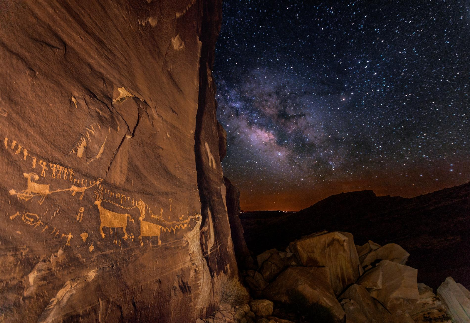
When I woke up in the middle of the night, responding to the call of nature, I strapped on my headlamp, stumbled outside, and then promptly switched it off. Above me, the stars were as crisp and detailed as the lights on a pinball machine. I stood there in a trance for what felt like half an hour, before recalling the real reason I’d come out, and then crawling back inside to bed.
The next morning, after departing the tiny town of Gateway, the road opened up into a vast avenue of towering sandstone cliffs and scorching red earth — “road runner country,” as the locals call it.
Parts of the route follow the Dolores River, a tributary of the Colorado. The water, which was recently melted snow, was absolutely frigid. Still, that didn’t stop Joe and me from tearing off our clothes when we came to a suitable pull-off, and wading in for a refreshing, albeit icy, dip. A few trucks roared by on the highway beside us, but mostly the traffic was nonexistent.

Driggs Mansion and Thimble Rock.
The next part got tricky, however. Having planned to reconvene at an overlook 15 miles ahead, I was left on my own to begin the arduous climb up from the river. By that point it was the middle of the afternoon — and it was hot. With the sun beating down, each new bend in the road made a fresh demand on my poor quadriceps and knee joints. I felt like I was barely keeping up.
The road rose up and wrapped along the edge of a massive red rock wall, which was candy-striped from centuries of water drippage. To my left, a rounded cliff with a hole carved out looked just like the head of a whale, and its kindly expression seemed to say: “You’re going to be fine.” Was I hallucinating from the heat? Hard to say. Either way, the spectral cetacean’s words had a calming effect, and I continued biking until, just past a lookout point over the zigzagging Dolores, the road finally started to slope downhill. What goes up must come down.
The day’s excitement was not over, though. After crossing an abandoned bridge over the San Miguel River, I descended into a narrow slot canyon filled, to my surprise, with grazing cows. Whenever I rode past them, they would take off running. The closer I got, the faster they ran. Suddenly, I was a cowboy, trailing a herd of panicked calves along the rocky river banks until I was finally able to pass.
Eventually, I emerged at the edge of an arid wasteland, spat out the other end of the wrinkled, sky-reaching mesas. I needed a refreshment, and luckily, 10 miles ahead, there was the Bedrock Store, where Joe was waiting, reading a paperback copy of Steinbeck’s “The Pastures of Heaven.” Like a time capsule from the 1910s, this roadside depot had creaky floorboards and soda in glass bottles. ( The storefront was used as a filming location for “Thelma & Louise.” ) My friend and I sat on the porch and devoured a bag of chips while a Bichon Frise named Ziggy curled up in my lap.

Greeting the sun as it begins its morning rise over Paradox Valley.
Suddenly, the end of the road
What’s impossible to control, especially in a high-altitude place like Colorado, is the weather. On Day 3, After successfully climbing 1,000 feet out of Paradox Valley, I hurtled down Highway 90, euphoric to finally arrive at the Colorado-Utah state line. We posed by the “Welcome to Colorado” sign and snacked on peanut butter and jelly sandwiches we’d made at the hut that morning.
Then, I got back on my bike, headed up Highway 46, and had a sense of foreboding as soon as I hit the saddle. The temperature was quickly dropping, the sky was leaden, and ahead of me was a nine-mile ascent, in the cold, with the likelihood of a storm breaking right over me.
Joe pulled up 50 yards ahead, and when I rode up, he lowered the window and stuck his head out. “Well?” he asked halfheartedly, nodding toward the back seat. Begrudgingly, I packed up my bike and got in the car.
It’s a bittersweet feeling to give up when you know your goal is unattainable. With a little more training, or some sunshine, I felt I could have tackled this final haul into Utah.
On the plus side, I knew I’d made the right decision. As we began to drive, now in the warm safety of Joe’s car, the road took a ruthless pitch up the back of La Sal Mountain, easily the steepest road I’d encountered so far. The curves were sharp, the shoulder was narrow, and most noticeably the rain was coming down hard.
Toward the crest, as we neared the 8,000 foot mark, still 20 miles from Moab, the view suddenly widened, and across some meadows we could follow the contour of Mount La Sal, almost within reach, to where its peak was wreathed in white wispy cloud.
So near and yet so far.
https://mp.lookbk.me/mp/lookbook/e1fJqf7 .....INTRIGUING AERIALS OF A COLORADO YOU'VE NEVER SEEN BEFORE
Photographer Evan Anderman captures the eastern plains from the cockpit of his Cessna 206.


Saving Grouse


Well before dawn, near the Little Snake River in southern Wyoming, Pat and Sharon O’Toole’s pickup bounces up a broad, sage-covered valley, where the family has run livestock for five generations. Pat turns off the headlights and rolls toward a clearing. Under a moon that’s just past full, we make out dozens of white dots, hopping up and down on the dark plain. The sage grouse have been dancing all night. As the morning light grows over the eastern mountains, the outlandish mating ritual comes into view. The knee-high males strut around, puffing their white-feathered chests and splaying their tails. They chase one another and spar in a flurry of beating wings, heaving chests, and loud thunking. Meanwhile the females—smaller birds with brindled gray feathers that blend with sage and soil—stand around looking bored. It’s a ridiculous spectacle, and the human analogies are inescapable: singles bar, Venice Beach boardwalk, Senate hearing.

The greater sage grouse is “unquestionably the most comical-looking bird I have ever seen,” ornithologist Charles Bendire noted in 1877. Back then there were millions of sage grouse across the American West. Native peoples and Anglo settlers alike hunted them for feathers and food. Camping in one Wyoming valley in the 1880s, naturalist George Bird Grinnell found it so crammed with grouse that it became a “moving mass of gray.” Such scenes are hard to find today.
Less than 10 percent of the bird’s original population remains, about half a million birds scattered across 11 western states and two Canadian provinces. Sage grouse need undisturbed sagebrush; the tough, drought-resistant shrub feeds the birds, especially in winter, and shelters them and their nests. But sagebrush is in retreat everywhere. Massive overgrazing a century ago cleared the way for invasive grasses that now fuel devastating fires in the western part of the bird’s range. Roads and subdivisions, transmission lines, farms, gas fields, and wind turbines—all disrupt what was once an unbroken sea of sage.
Preserving sagebrush for grouse would help other animals that depend on the same habitat, such as pronghorn, mule deer, pygmy rabbits, and burrowing owls. But it might prove costly to ranchers, miners, oil and gas developers, and real estate brokers. In 2015 then President Barack Obama’s administration brokered what it hailed as a historic collaboration among those competing interests. Now President Donald Trump’s administration is weakening provisions that steered oil and gas drilling away from areas that had been reserved for sage grouse.
It’s the age-old battle between those who want to preserve western lands and those who want to extract a living from them—only in this case, the burden falls on a comical, knee-high bird. As the sage grouse goes, so goes the West.
ONE OF THE BIGGEST FACTORS in the grouse’s decline these days may be the astonishing increase in natural gas production in places such as the Green River Basin, south of Pinedale, Wyoming. In 1984, when biologist John Dahlke first visited, the basin contained sagebrush, a few fence posts, some two-track roads, and not much else—except the largest known winter concentration of sage grouse. They would lift from the sage in lumbering waves, Dahlke recalls: “The sky was full of them, bumping into each other, falling down.”
That basin is now home to one of the most productive gas fields in the region. Called the Jonah Field, it’s crisscrossed with roads and cluttered with chugging, groaning infrastructure: gas wells, drill rigs, pipelines, sage-camouflaged service huts. Nearly all of that is on federal land.
“It happened stunningly fast,” says Dahlke, who works as a wildlife consultant in Pinedale. “From absolutely silent, just the wind or the hiss of snowfall hitting the ground, to an industrialized landscape.” The breakneck change has proved particularly hard on sage grouse because of their fidelity to ancestral mating and nesting grounds. Males return each spring to the same leks—clearings where they do their mating dances. Females usually nest within 500 yards or so of the previous year’s nest. Their chicks settle nearby.
“Sage grouse are very poor pioneers,” Dahlke says. Rather than set off for better habitat—which is more and more limited—they dance doggedly on and nest among the bulldozers and flaring gas wells. Most birds survive in the short term, Dahlke says, but “incremental impacts” take their toll. The number of leks has dwindled. “The enormous winter flocks are now gone from the Jonah Field,” Dahlke says. “They are gone.”
ONLY IN THE EARLY 1990S did scientists start to realize the extent of the sage grouse’s decline across the West. In 1999 conservation groups filed the first petition requesting that the bird be protected under the Endangered Species Act. But for years the federal government, hamstrung by tight budgets and pressure from business interests, put off a reckoning. Listing sage grouse as endangered would sharply limit economic activity on the 173 million acres of public, state, and private land where sage grouse live.
But the threat of a listing motivated states to take action. In 2007 Wyoming, which houses more than a third of the remaining sage grouse and has an economy that depends on fossil fuel extraction, brought together a broad coalition—ranchers, industry representatives, conservation groups, land managers, and politicians—to create a policy to halt the bird’s decline.
“We battled it out mightily,” says Paul Ulrich, director of government affairs at Jonah Energy, which operates on the Jonah Field. “And then we put our interests aside and asked, ‘What is best for Wyoming?’” The group ultimately agreed to limit any development and restore disturbed areas within “core” grouse habitat—not including the Jonah Field, where the grouse population was already diminished—while allowing more intensive development elsewhere.
The Obama administration’s $60 million federal plan was modeled on Wyoming’s. No faction got everything it wanted. But, Ulrich says, “it’s demonstrably working.” Industry got certainty: The administration promised it wouldn’t list sage grouse as endangered. Conservationists, says Brian Rutledge of the Audubon Society, got limits on development in important habitat. “Do we have issues?” Rutledge asks. “Of course. But we set standards and are measuring impacts. To me this is the future of conservation.”
Not everyone agreed. Groups on left and right filed suit, arguing, respectively, that the plan would not adequately protect grouse or that the restrictions were “draconian.” “The certainty of not being able to develop is not the kind of certainty we want,” says Kathleen Sgamma of Western Energy Alliance, an industry group.
The Trump administration agrees: For the sake of energy independence and not “destroying local communities,” as Interior Secretary Ryan Zinke put it, the Bureau of Land Management has proposed lifting some restrictions on development in key sage grouse habitat. Under another proposed policy, which could affect many species, the administration would allow regulators to consider not only the science but also the economic impact of listing species as endangered.
ON THE O’TOOLE RANCH, the sage grouse dance ends without romance. The females lurking on the edge of the lek finally choose. Most mate with the same male. A female turns and arches her wings, and the deed is done in a matter of seconds. The sun climbs higher, and the birds scatter back into the brush.
Before the endangered species petitions, Pat O’Toole says, “we never paid much attention to sage grouse. They were just part of the landscape, like deer.” He participated in the state and federal negotiations and is generally happy with the results. The federal plan made funds available to maintain habitat both for the grouse and for his livestock. This particular area, which will serve as a lambing ground later in the spring, is home to six grouse leks and countless other creatures—pronghorn, mule deer, bald and golden eagles. “It’s an intact system,” Pat says.

There are species—such as ravens, which now use oil rigs as perches to prey on sage grouse—that manage to flourish when their environment shifts. Sage grouse are not among them. They are supremely evolved to live in the harsh, silent American steppe, but they are birds of little brain. “They’re not smart at all,” Sharon O’Toole says. They run into fences, stand in the middle of busy roads.
Humans, like ravens, are more adaptable. We can learn to do things differently. That’s what Audubon’s Rutledge believes: That we can alter the behaviors that trap us in time-worn conflict and chest-puffing displays of political dominance in the West. He hopes that collaboration on sage grouse, if allowed to work, will provide a template for other conservation efforts.
“Everyone says you can’t change this,” he says. “And if I’m rational, probably not. But I don’t think it’s any excuse not to try.”
Charlie Hamilton James specializes in images of wildlife but admits the low-angle shot of the sage grouse was the hardest photo he’s ever taken. “It took five weeks, a lot of coffee, and a pile of gear.”
.....Riding Through The American West


“It is a diverse, iconic, some say spiritual landscape,” says rancher Matt Redd. His family sold their 5,247-acre ranch to the Nature Conservancy in 1997, and it’s now the largest private tract inside Bears Ears. Redd still runs the cattle as part of research on how to manage land in a changing climate.

The push to cut back federally protected lands is fueling a dispute rooted in our history and culture. The big question: Whose land is it?
Deep in a box canyon in Utah, in the heart of the fractured land known as Bears Ears National Monument, there is a cave—a swooping, mineral-streaked alcove in a sandstone cliff.

In December 1893 a rancher-explorer named Richard Wetherill pushed his way through dense reeds and discovered inside that alcove a stacked-stone ruin where a prehistoric group of Native Americans once lived. He named the site Cave Seven. Some would later condemn him as a vandal and a looter—but Cave Seven proved to be one of the most important finds in the archaeology of the American Southwest.
It’s easier to get there today than it was in Wetherill’s era, but it’s not easy. You bump along a dirt road that twists long miles through arroyos and canyons, past jagged crags and sandstone domes. Then you are on foot. You clamber through a dry watercourse clogged with bitterbrush and poison ivy; you sidle along a rock ledge. Look up: A dissolving jet contrail is the only sign of the time in which we live. Look down: What seem like stones at your feet are in fact remnants of cooking vessels. Such relics are everywhere, if you know how to look: A saltbush-covered mound conceals a ceremonial kiva; a subtle line in the earth marks a road connecting ancient villages. All around is evidence of things made, laid, and lived in centuries ago.
Picture of petroglyph depicting a ceremonial gathering of some 190 humanlike forms converging from four directions. A succession of prehistoric cultures occupied the mesas and canyons of southern Utah for more than 12,000 years.
One treasure still inside the Bears Ears monument is Procession Panel, a nearly 23-foot-long rock carving, or petroglyph, on Comb Ridge. At least 1,000 years old, it depicts a ceremonial… More Photos
Wetherill excavated the surface ruin at Cave Seven, selling the artifacts to museums and collectors, leaving only a bit of masonry wall and smoke smudges. Then he kept digging. He had recently learned the novel concept of archaeological stratigraphy: the idea that prehistory is recorded in successive layers of sediment. Earlier remains lie beneath later ones—ruins under ruins, cultures under cultures. At Cave Seven, Wetherill found below the visible ruins a burial site that predated them by hundreds of years. He dug up 98 skeletons from a previously unknown Basketmaker society. Deep in this forgotten canyon, deep in time, one culture had given way to another.
Bears Ears National Monument is now a battleground in another collision of cultures. Across the American West, from the desert canyons of Utah to the towering conifers of the Pacific Northwest, and in the mountains and sagebrush basins between, Americans are engaged in bitter disputes over public lands. Nowhere has the battle been fiercer than around national monuments, particularly Bears Ears, which then President Barack Obama created in December 2016.
Last December, President Donald Trump reduced the 1.35-million-acre monument by 85 percent and divided it into two smaller units, Indian Creek and Shash Jáa. He cut nearby Grand Staircase-Escalante National Monument by 46 percent. Interior Secretary Ryan Zinke also recommended shrinking other monuments, including Cascade Siskiyou in Oregon. He declined to be interviewed.


Example petroglyph, picture of human figure surrounded by intricate ornament. Picture of pictograph of a bee.
See All Photos 1/10Threatened History
Petroglyphs and pictographs— images carved and painted onto rock—bear witness to the long and abiding connection of Native Americans to Bears Ears. The images here span millennia… They were made by nomadic hunter-gatherers of the Archaic period, which ended with the adoption of agriculture by about 1500 B.C.; by the Basketmakers, the first sedentary farmers, between 500 B.C. and A.D. 750; by ancestral Pueblo people, who built large cliffside settlements but migrated out of the region at the end of the 13th century; and by Ute and Navajo, who moved in later from the north and remain there today. Archaeologists have barely begun to interpret the enigmatic and irreplaceable art of the Bears Ears region. Isolation once protected it, but the recent influx of visitors has subjected some works to damage: graffiti, bullet holes, and even wholesale removal by looters armed with rock saws.
Description of other panels:Panel 8 was probably made before A.D. 1300 by Pueblo people. Threatened History
When Congress passed the Antiquities Act in 1906, authorizing the creation of such monuments, it was partly in reaction to the theft of Native American artifacts by people like Wetherill. The law gives presidents broad discretion to protect “historic landmarks … and other objects of historic or scientific interest” on federal land. Designating a monument requires no input from Congress. “A president could literally scratch something out on a bar napkin,” says University of Colorado law professor Charles Wilkinson. There is no language in the law, however, granting subsequent presidents the power to amend monuments created by their predecessors. In the days after Trump slashed the two Utah monuments, five lawsuits challenged the legality of the move. Those suits are pending too.
Republican presidents such as Theodore Roosevelt, who signed the Antiquities Act into law, have designated large monuments, but the number and acreage have grown dramatically in recent years, particularly under Democratic administrations. Like so much else, the struggle over western lands has become politically partisan. Trump’s reductions were part of a larger campaign to reverse Obama’s public land policies—by opening protected lands and waters to mining and drilling, by easing regulations, and by rolling back habitat protections for struggling species. (See related sage grouse story.)
The reactions have fallen along predictable lines. Drillers and miners, loggers and ranchers, face off against hikers and bikers, climbers and conservationists. It’s the Old West versus the New; the people whose livelihoods depend on extracting resources from the land versus those who visit and the businesses that serve them—and at Bears Ears, the Native Americans who were there first. Both sides cry “Land grab!” Both sides feel they have the one true answer to the question: What is the best and highest use of the land that, in principle, belongs to us all?
Descend into a sacred ceremonial kiva in Grand Gulch, Utah, to experience a centuries-old ritual guided by traditional musician Marlon Magdalena.
To interact with this 360-degree video, click and drag anywhere on the video. For the best experience, view this video on a computer. (Building fires within cultural-resource sites on public lands is illegal and can damage the integrity of the sites. This 360-degree video includes a virtual simulation of a fire; no fires were lit on public lands in the making of this video.)Western lands have been a subject of intense dispute ever since the U.S. government seized them from native tribes. As the nation’s rough edge expanded toward the Pacific in the 19th century, the transfer of “free land” to homesteaders, railroads, livestock barons, and mining syndicates was seen as part of building a nation. By the 1870s, however, that sense of the common good began to shift. In the upper Midwest, loggers had reduced magnificent forests to swampy fields of stumps. “People began using the phrase ‘timber famine,’” says historian Patricia Nelson Limerick, and to worry that such rapid depletion of resources posed a long-term risk to the nation.
Out of that newfound sense of limits was born the notion of public land, managed in perpetuity by the federal government for the good of the nation. In 1872 President Ulysses S. Grant signed a bill creating Yellowstone National Park—the world’s first. Congress empowered presidents to create forest reserves in 1891, and millions of acres of timberland are now managed by the U.S. Forest Service. In the 20th century the General Land Office, which later became the Bureau of Land Management, slowly shifted its focus from selling “leftover” grasslands and desert to managing grazing and mineral extraction on those lands. Then as now, critics responded with outrage. “As nefarious a scheme as ever disgraced the nation,” wrote foes of the forest reserves. “A fiendish and diabolical scheme,” argued opponents of protecting the Grand Canyon.
Explore perfectly preserved petroglyphs and spectacular multistory ruins of River House—an ancestral Pueblo village on the San Juan River in Utah—with Brian Monongye, a Hopi artist, farmer, and community leader.
To interact with this 360-degree video, click and drag anywhere on the video. For the best experience, view this video on a computer.
That dynamic hasn’t changed. The federal government still owns 575 million acres across the West—nearly half the total land of the 11 western states in the lower 48, including 63 percent of Utah and 80 percent of Nevada. Each action to protect or manage those lands has met with angry reaction. From the 1934 law that required leases for grazing, to the environmental laws of the 1960s and ’70s, to protections for endangered species, Westerners have responded with legal action and sometimes violent resistance. They’ve planted bombs and summoned horse-riding, flag-waving, gun-toting protesters.
Nevada rancher Cliven Bundy and his sons typify that rebellious spirit. In 2014 the Bundys and their supporters held off federal agents seeking to impound cattle that the family had grazed on federal land for more than 20 years without paying fees. In 2016 Bundy’s sons traveled from Nevada to Oregon to occupy the headquarters of Malheur National Wildlife Refuge after two Oregon ranchers who had clashed with refuge managers were imprisoned for arson. Trump recently pardoned the convicted ranchers.

By now it’s a familiar story. The government changes the rules or resolves finally to enforce them; tensions build and explode across the jigsaw ridges of the American West. “It’s not unlike when they adapt Shakespeare for modern settings,” Limerick says. “The script is the same, but Lear is wearing a business suit.”

Picture of red rock defensive outpost high on a cliff.
Picture of Apache dancers honoring Navajo elders by performing a crown dance. More pictures, here!
Left:Ancestral Pueblo people built this defensive outpost high on a cliff sometime between A.D. 1100 and 1275. By the end of the 13th century, they left the region, driven out by an epochal drought that probably led to conflict over scarce food and water. Cultural clashes, more peaceful for the most part, continue to erupt across the American West today.
Right: Just outside Bluff, Utah, on the edge of the Bears Ears monument, Apache dancers honor Navajo elders by performing a crown dance. The fight for the monument brought together dozens of tribes. “To Native Americans, natural resources are a gift,” says Navajo activist Willie Grayeyes. “When you receive a gift, what do you do? Do you throw it away? No, you put it in a safe place and cherish it.”
On a blazing afternoon in July 2017, a fashionably rugged mob descended on the Utah statehouse in Salt Lake City. They had begun a mile away at the convention center, where the Outdoor Industry Association was holding its summer show of recreation gear—backpacks, tents, portable espresso makers—for the last time in Salt Lake. Frustrated by Utah legislators’ unrelenting opposition to the Bears Ears monument, the trade group had decided to move its lucrative gatherings to Colorado.
Wearing river sandals, eco-sloganed trucker hats, crocheted bear ears, and bald eagle costumes, the group marched past the Mormon archives and temple, singing and chanting (“Get Your Tiny Hands Off Our Public Lands!”) and waving signs (“Speak Loud for Quiet Places”). Among the speakers who addressed the crowd was Northern Ute councilman Shaun Chapoose—on this issue the West’s oldest inhabitants had allied with its newest. “Our lands were taken,” Chapoose said. “Now yours are too.”
The Bears Ears monument, named for twin buttes that jut above Cedar Mesa, owes its origin to an unprecedented coalition of local tribes. The original monument was estimated to include more than 100,000 ancient sites—cliff dwellings, kivas, great houses, and burial sites like Cave Seven. All were built by peoples who lived in the region for millennia but then departed at the end of the 13th century, driven out by drought and conflict.

Picture of a sunrise prayer with members of Hopi, Zuni and New Mexico Pueblo tribes, Ute and Dine.
Kenneth Maryboy (in blanket), a Navajo activist, leads members of Hopi, Zuni, Ute, and other tribes in a sunrise prayer. Utah Diné Bikéyah, the nonprofit whose board Maryboy serves on, was established by Navajo, but it became the nucleus of a broader intertribal coalition set up to protect Bears Ears. More Pictures here.
Today their Hopi, Zuni, and Pueblo descendants still consider the region their ancestral home, as do the Navajo, Ute, Paiute, and Apache who moved into southern Utah and Colorado after the early Pueblo left. For years native leaders negotiated with local, state, and federal officials, seeking a legislative compromise on how the land should be managed. As the effort foundered in Congress, tribal and conservation groups pushed Obama to designate a monument before he left office.
The urgency wasn’t merely political. The area’s arid climate and profound isolation had long helped protect its archaeological treasures—the rock art, potsherds, and tools, the human remains, the thumb-size corncobs. But our era of geotagged photos has made it easy to locate obscure sites. In the decade before the monument was created, visits to the area surged.
With rising and unregulated visitation has come more damage: tourists pocketing potsherds, campfires burning wood from century-old Native American shelters, graffiti on rock art, off-road vehicles blasting through burial grounds. “The strategy of leaving it alone and trying to keep it a secret is unsustainable,” says Josh Ewing, executive director of Friends of Cedar Mesa, a conservation group.

Picture of bicycles and trucks on a narrow trail along a cliff.
During Moab Jeep Jamboree USA, held every October, traffic on the Cliffhanger Trail near Moab, Utah, can grind to a halt. The tourist crush unnerves locals on both sides of the national monuments debate, many of whom fear their own quiet rural towns will become another Moab.
More Pictures, here.Nor are heedless vacationers the only threat. Wetherill’s discoveries launched a tradition of organized pothunting by white settlers. “The trashing started in the 1890s,” says Wilkinson, an adviser to the tribes who petitioned for the monument. “Pots were selling in London, Berlin. And skeletons—skeletons! It was carnage.”
Although the Antiquities Act outlawed collecting artifacts without a special permit on public land, even if it isn’t a monument, the desecration continued. In 1986 federal agents seized hundreds of illegal artifacts in Blanding, a town of 3,700 near Bears Ears; in 2009 the feds descended again, arresting 26, including two county commissioners and a beloved local doctor, who killed himself the next day. For many in Blanding, the raid screamed federal overreach; for native communities it only proved that existing safeguards hadn’t worked. “It got people thinking about how to protect all these ruins,” says Gavin Noyes, director of Utah Diné Bikéyah, a tribal nonprofit.

A Monumental Challenge

Two national monuments in Utah, Bears Ears and Grand Staircase-Escalante, are treasured by many but are also politically contested. In 2017 President Donald Trump ordered the monuments shrunk by approximately 85 percent and 46 percent, respectively, paving the way for resource extraction and setting off a challenge in the courts. The newly opened regions are steeped in Native American history and archaeological sites—but also in coal and uranium.
URANIUM RESERVES
An estimated 62 billion tons of coal lie in the
Kaiparowits Plateau, major areas of which are now
no longer part of Grand Staircase-Escalante National
Monument. The coal deposits are buried deep and
would be expensive to mine but are in demand by
foreign steel producers.
Oil and gas reserves in the newly opened territories
around Bears Ears are estimated by geologists
to have low potential. Uranium deposits, however,
located near previously active mining sites in the
western and northeastern regions of the opened
territories, hold more promise.
*For clarity, archaeological sites still protected within reduced monument extents are not shown.
Mary Jane Yazzie sits on its board. A petite woman with short hair and long silver earrings, she is one of the last fluent speakers of the Ute language. The Ute Mountain Ute reservation near Blanding is cluttered with artifacts of modernity: pickup trucks, generators, satellite dishes. But the view from behind Yazzie’s house is ageless. To the west lie the Bears Ears buttes, held sacred by Ute and Navajo; to the south the land drops toward Comb Ridge, an 80-mile wall of sandstone that, in Navajo tradition, forms the Earth’s backbone.
“The land belonged to our grandfathers,” Yazzie says. “They went hunting. The women gathered herbs, nuts, berries.
“We’re tied to the land as if the land tied us to it: There’s no way we’re going to get away from it until we’re no longer on the Earth.”

“It is a diverse, iconic, some say spiritual landscape,” says rancher Matt Redd. His family sold their 5,247-acre ranch to the Nature Conservancy in 1997, and it’s now the largest private tract inside Bears Ears. Redd still runs the cattle as part of research on how to manage land in a changing climate.
The tribe’s Mormon neighbors have their own deep connection to the land and their own origin story, though it goes back only a few generations—to 1879, when some 250 Mormons spent six months blasting a road down a cliff and navigating a maze of canyons to reach a verdant plain along the San Juan River, where they built the town of Bluff. The river was prone to flooding, however. Most of the community eventually moved uphill to farm on the sagebrush plateau around Blanding, 25 miles north.
In Blanding you can see the Bears Ears from almost anywhere. Even adamant monument opponents express a deep affection for the federal land that surrounds the town. “I like public lands,” says San Juan County commissioner and state legislature candidate Phil Lyman, a descendant of Mormon pioneers. “You hike for miles and miles and miles and don’t ever stop to think, Am I trespassing?”
But he and other monument foes also believe the land can and should generate profit. “I would like to know there’s the ability to speculate on energy in that area,” Lyman says. There are lucrative oil and gas fields just outside the old monument but no producing wells inside, and the rugged, remote, and archaeologically sensitive terrain makes such efforts unaffordable—unless oil climbs back above, say, $100 a barrel. Trump’s Interior Department consulted with energy interests in drawing the monument’s new boundaries. “I suspect there’s potential,” says Lyman, who owns uranium claims.
Read MoreAn awkward bird symbolizes the fight over America's West
What the Bears Ears monument means to a Native American
In 2014 he led a rowdy group of protesters, including Bundy’s sons, on a ride into Recapture Canyon, which had been closed to protect ancient sites. He was jailed for that. Federal land managers “have become very much the enemy,” Lyman says. For generations, locals could cut trees and camp and drive their four-wheelers wherever they wanted. Environmental rules have restricted those freedoms, Lyman says.
Yet just as disturbing, to monument friends and foes alike, is the prospect of too much access.
“National monuments don’t necessarily bring more protection. They bring more traffic,” says Nicole Perkins, a librarian in Blanding. She cites the specter of Moab, the rollicking recreational mecca 75 miles to the north, where a four-lane neon strip hosts an unceasing parade of RVs, ATVs, and rafting rigs. No one wants that for Bears Ears. “I came here for the silence and the stars and the vistas,” says Bluff hotel owner Jim Hook. Notoriety has filled his hotel—but stolen some of that silence from everyone.
In the spring of 2016, as the Obama administration considered the petition to make Bears Ears a monument, Perkins attended a community meeting with Blanding resident Janet Wilcox. A teacher spoke, explaining that her family lived across the Colorado River in the town of Escalante. “They had lived through 20 years of a national monument,” says Wilcox. “She said, ‘You have got to wake up.’ That’s what got me involved.”
Escalante, in the secluded heart of Grand Staircase-Escalante National Monument, is a long, sinuous drive from anywhere. Before the monument, it was a somnolent square mile of homes and farms with wide, empty streets and about 800 residents. A timber mill processed logs from the national forest above the valley. A hundred or so ranchers grazed cattle on the surrounding federal land.
Picture of elderly farmer getting into his truck near a waterhole.
Sandy Johnson fills his water truck on federal land cut from the Bears Ears monument. A fifth-generation rancher, he runs livestock on 300,000 acres of mostly public land—and worries about government regulations. “We don’t need that monument,” he says. “The land needs to be left alone so everybody can use it.”
President Bill Clinton created the monument as he campaigned for reelection in 1996. He cited its breathtaking scenery—cloud-shaped rock formations, elephant-humped ridges, whorled slot canyons plumbed by waterfalls. His administration had done the preparatory work in secret, knowing that local politicians would be furious. And fury there was: Grand Staircase-Escalante was, in many ways, the original sin that spawned the current backlash against the Antiquities Act. It covered nearly 3,000 square miles.
In the 22 years since, Escalante has served as both inspiration and cautionary tale for other communities. Tourism attracted by the monument supports new hotels, restaurants, and guide services. The town has a new hardware store, a dentist, and a health clinic—before, a doctor saw patients once a week in the high school gym. It has a housing crunch and, in some sectors, a labor shortage. Electricians and plumbers are booked out for months.
Many of them work for “move-ins” such as Steve Roberts, a serial entrepreneur with thick-rimmed glasses who first visited after Clinton protected the area. “Escalante is magical,” Roberts says. In 2004 he bought Escalante Outfitters, a busy restaurant–bookstore–camping-supply store. (He has since sold it.) That year he also started an arts festival. Visit in late September, and you’re likely to see artists with umbrellas and easels painting blooming datura flowers or landscapes of white-rock immensity. Picture of aerial of uranium mill with three ponds.

Picture of Uranium miner sitting next to entrance into the Royal Flush mine.
Left: The White Mesa Mill, the only licensed and operating uranium mill in the United States, sits adjacent to an area that Trump cut from Bears Ears National Monument. The cuts also removed many mining claims from the monument. The mill’s primary shareholder, Energy Fuels Resources, questioned the original need for the monument and lobbied for smaller cuts near its own facilities. But the company now supports a mining ban within the original boundaries, says spokesman Curtis Moore.
Right: Kyle Kimmerle, a fourth-generation miner, sits inside the Royal Flush mine, a vanadium and uranium claim in an area near the recently scaled-back Bears Ears. Kimmerle owns a tire store in Moab, but if mineral prices were to recover, he says, “there’s nothing I would love more than to go mining again. It’s bred into my blood and bones.”
Some locals, however, believe the monument has hurt the region. After the designation in 1996, the government bought out coal leases on the Kaiparowits Plateau, inside the monument, and a planned coal mine never opened. Existing grazing leases were preserved and cattle numbers have remained steady, but ranchers complain that new environmental rules make it harder to prosper. The lumber mill, which struggled for years, closed for good in 2009.
“The natural resource jobs went away,” says Drew Parkin, a resource manager who once worked at Grand Staircase-Escalante but came to oppose how the monument was managed. “In an environment like this, tourism jobs can’t take their place—full-time jobs, with benefits, year-round.” In winter the only restaurant open in the town of Escalante is a Subway in a gas station. High school enrollment has dropped by more than half; young families have left.
Read More Beautiful Photos of Day of the DeadThose declines, though, reflect larger trends across the rural West. “People blame the monument for everything bad,” Roberts says. Escalante’s travails predate the monument: Its population peaked in 1940 at more than 1,100 residents, and by 1970 it bottomed out at just over 600. Overgrazing, which made ranching less profitable, was one factor. A coal mine would have brought new jobs, but for how long? The coal market is depressed.
Instead it’s the New West economy that’s bringing employment. “I could name 10 businesses someone could start tomorrow that would thrive here,” says Blake Spalding, a wild-haired Buddhist restaurateur who co-owns Hell’s Backbone Grill in nearby Boulder, Utah. Her restaurant and 6.5-acre organic farm support 50 seasonal employees. “Most of them make double the minimum wage,” she says—albeit only from March to November.
Cutting the monument by nearly half, as Trump has done, is unlikely to jump-start the old economy—the coal is still too expensive to mine—but it has introduced uncertainty in the new one. “It’s been 22 years now,” says Spalding. “These gateway towns are full of people who made lives and families around the monument.”
“To gamble with the new economy that has grown up around the monument is shockingly reckless,” adds Nicole Croft of Grand Staircase Escalante Partners, a conservation group. In the years since the monument was created, Croft says, the move-ins had reached a kind of peace with the descendants of the Mormon pioneers. But Trump’s cuts have rekindled old hostilities. “It snapped really fast,” she says. Picture of the the geologic formation resembling mushroom.

The Wahweap Hoodoos are one of the geologic marvels excluded from Grand Staircase-Escalante National Monument since Trump cut it nearly in half. The monument has boosted tourism, but some locals believe it has hurt the old economy based on ranching, timber, and mining.
Before anyone moved in and claimed the land—before natives, settlers, loggers, ranchers, second-home owners—there was the land itself. A thousand miles from Utah’s desert canyons, on the Pacific Crest Trail in southern Oregon, Dave Willis is keenly aware of that fact.
A Pacific storm is blowing in, clouds boiling with moisture. Willis, who chairs the Soda Mountain Wilderness Council, has been advocating for this piece of the West—which now includes Cascade Siskiyou National Monument—for decades. At press time Trump hadn’t acted to cut the monument. Willis lives in its heart, in a tumbledown trailer in a former logging town. Short and sturdy, with a ruddy, graying beard, he lost large parts of his hands and feet to frostbite years ago, climbing in Alaska. He rides the trails on horseback.
Cascade Siskiyou was the first national monument named specifically to protect the plants and animals that predate us all. Clinton carved the monument in June 2000 from a landscape of hazy timberlands and undulant chaparral. It covered 85,000 acres then, including 32,000 acres of private inholdings, and the range of elevations and life zones it spanned made it, says Willis, “a veritable Noah’s ark of botanical diversity.” There are hundreds of species of flowering plants. Chickadees, hummingbirds, gnatcatchers, spotted owls, all adapted to different ecologies, live here in close proximity.
The original monument was small and not particularly controversial. But in 2011 a group of scientists determined that, as humans encroached on nearby habitat and as climate change pushed species outside the monument, its current boundaries weren’t sufficient. Heeding that argument, Obama doubled its size a week before he left office. Timber interests promptly sued, along with counties that had received timber revenue from land in the expansion area.

TPicture of smoke from burning coal seam.
Picture of a two-foot-long segment of a duck-billed dinosaur tail remains embedded in sandstone.
TLeft: A coal seam burns on the Kaiparowits Plateau. Fires inside coal seams—often triggered by lightning—can burn underground for hundreds of years. Some locals hope shrinking Grand Staircase-Escalante National Monument will revive plans for a coal mine that were shelved after President Bill Clinton created the monument in 1996.
Right: Bones from the spine of a hadrosaur remain along a weathered sandstone ridge on the Kaiparowits Plateau, an arid, bell-shaped upswelling rich in both dinosaur fossils and fossil fuels. The Trump administration removed parts of the plateau from Grand Staircase-Escalante.
TThe resource economy in southern Oregon has been hurting for a long time. The number of timber jobs in the state has dropped from 15,000 to 5,000 over the past 40 years; a mere 385 remain in Jackson County, home to Cascade Siskiyou. County Commissioner Colleen Roberts grew up in nearby Klamath Falls. Her father worked in timber. “When I was in high school, that’s what the boys did, and it was good money,” she says. She opposes the monument expansion.
TSo does Lee Bradshaw, a third-generation rancher with an eagle nose and extravagant mustache. In a sun-baked meadow just outside the monument, he lays out a salt block and shouts for his cattle. The expansion preserved his grazing leases, but he’s seen neighbors quit and worries he’ll be regulated off the land. “I’ve never done nothing else but run cattle,” he says. Some years he doesn’t turn a profit; he gets health insurance through his wife, a nurse. “I never got in it for money. The only reason we do it is it’s our heritage. I want this to go on to my kids.”
TTo activists like Willis, heritage is no excuse. “What’s the result on the land of those connections to the past?” Willis asks. “Ranchers pay $1.41 a month for cattle to poop in creeks, break down streambeds, and spread weeds. They are the lords and ladies of yesteryear.”
TWillis has his own preferred version of yesteryear: an old-growth grove that his group fought, successfully, to save from timber harvesting and include in the expanded monument. Red ribbons still droop from once doomed trees—ponderosa pines, lofty Douglas firs—as he rides into the heart of the grove. The wind rustles the high canopy; down below it is utterly still. Willis raises an arm toward a massive ponderosa.
T“How old is this pine?” he asks. “Older than our nation.” He looks at the canopy around him. “This, here, is a forest,” he says. “And it’s tragic and heartbreaking that there’s so little of it left.”
T“Of what avail are forty freedoms without a blank spot on the map?” the writer and conservationist Aldo Leopold once asked. Today, Willis says, “blank spots are having a rough go of it.” Americans look at the same breathtaking western landscapes and see different things: irreplaceable forests and canyons, the great houses and gravesites of cultures past, the homes and heritage and livelihoods of today. As the blank spots dwindle, the visions collide. Everyone feels something cherished is being taken away.
The legal challenges to Trump’s monument reductions in Utah may take years to resolve. But in August the administration proposed new management plans for the truncated monuments; its “preferred alternative” for lands removed from Grand Staircase-Escalante would open up nearly 660,000 acres to resource extraction. Mining interests are already staking claims. It’s unclear whether mining can proceed before the president’s legal authority to shrink monuments has been established. “I’m very concerned there’s going to be irreparable harm here,” says Croft, the Escalante conservationist.
Opposition to protecting western public lands has flared up ever since public lands were invented, yet the amount of protected land has—at least until now—steadily increased. Can any single presidential administration stand athwart history, demography, and economics in the West? Can it resist the new culture that—for better and worse—is supplanting the old one?
Some people hated setting aside the Grand Canyon, says Steve Roberts in Escalante. Now it’s an iconic national park. “How do you quell all this resentment and hate?” Roberts asks. “That’s easy. Wait three generations.”
Adver
Subscribe for $1 a week. Ends soon.
This is your last free article.
Support independent journalism.
Subscribe.
Unlimited articles on any device.
$3.75 $1.00/week for one year
QUICK CHECKOUT
Comments
Post a Comment